Thursday, September 27, 2012

Ancient Martian river bed

The recent press conference on Curiosity's scientific findings announced the discovery of a kind of rock called a 'conglomerate' which is a kind of sedimentary rock consisting of pieces of other rocks (called clasts) bound all together by a cementing matrix.
Conglomerate boulder (Commons)

Such rocks can tell us a lot about the kind of environment that they were deposited in; fluvial, glacial, marine and others.If you recall dear reader Curiosity is currently in an area within an alluvial fan and therefore such materials are invaluable to study up close. According to the speakers at the conference, this is the first time they have seen such rocks up close (though they have seen them from orbit in places such as Holden crater).

Three rocks turned out to be conglomerates according to the speakers and they all apparently belong to the same layer of bedrock, starting with the exposed one back at the landing site; the scour mark dubbed 'Goulburn'.
The scour marks exposed bedrock consisting of conglomerate (NASA/JPL/annotation by me)
Then there are two others found along the journey to Glenelg; 'Link' named after a rock formation in the Northwest Territories of Canada and 'Hottah' named after the lake in the aforementioned area.
Hottah looking like a broken up street curb. It is tilted maybe because of shock from a recent meteorite impact. Note the 10cm scale bar. (NASA/JPL/MSSS) 
  A close up of Hottah shows protruding clast that has been rounded smooth by erosive forces which are interpreted to be due to water embedded in the matrix consisting of sand-sized material.
The rounded clast circled in white. The gravel pile to the left are clasts eroded out of the rock by wind erosion probably (NASA/JPL/MSSS)
Okay so how do we know these rocks were deposited in water and not something else like ice or mud or sand? The speakers talked about key evidence stemming from the size and shape of the clasts. These clasts are relatively big (few centimetres) so that they have been deemed too big to have been carried by something like wind during deposition. Their shape is rounded which is characteristic of  rocks found on the banks fast flowing river/streams estimated by the investigators to have been flowing at a 'vigorous' 3ft per second or almost 1m/sec. If the clasts were more angular this wouldn't be conglomerate any more but instead would be something called breccia.

The speakers also pointed out that the valley from which the alluvial fan originates from has been officially named 'Peace vallis' by the International Astronomical Union (IAU) the top body for astronomical nomenclature.
Peace vallis is seen in the left corner of this elevation map. Bradbury landing is marked with a cross (NASA/JPL/UA)
Investigating these rocks will be exciting as the clasts represent materials transported by water from the walls of the Gale crater. It is impossible to tell reliably how old these rocks actually are. But an estimate from one of the speakers puts the rounded clasts (that is the time it must have took to smooth them during transportation) at the more than a thousand years mark. Hard to tell without proper dating tools in a terrestrial lab.

So there you have it, 'fossil' (fossil here does not imply bones or remains of living organisms) evidence of a Martian stream. Exciting times! If you would like to learn more about conglomerates, visit this article on geology.com.
The rock 'Link' versus a terrestrial example of a conglomerate rock with a known water history (NASA/JPL/MSSS & PSI)

Cool Moon view from sol 45

What would I ever do without forums? Kudos to Fredk from unmannedspaceflight.com for spotting this real beaut of an image from the Curiosity's colour cameras showing the evening sky on sol 45 and, if you look closely, the ghostly image of the Martian moon Phobos!
Crescent Phobos in the evening Martian sky (NASA/JPL/MSSS)
A scene usually depicted in science fiction books, I never thought I would ever see such a view! Below is a cropped up view stretched to the limit to show the moon more clearly.
Crescent Phobos cropped (NASA/JPL/MSSS)
Beautiful, huh? Really makes Mars look more Earth like albeit this is a much tinnier moon compared to ours. This image was taken with the 100mm focal lenght camera aboard Curiosity. The speckles in the image are artefacts due to the JPEG compression format used for the images transmitted back to Earth. The compression is good for less memory hungry images but bad due to the artefacts involved. It is for that reason that we can't tell for sure if the apparent glow above the crescent in the image is infact a real 'Mars shine' i.e. light reflected from Mars illuminating the dark side of the moon or not. We'll probably hear more about this tomorrow at the press conference. Stay tuned!

Wednesday, September 26, 2012

News conference alert!

There will be a televised (NOT teleconference) news conference tomorrow at 2000hrs GMT. From the JPL website:
 NASA will host a news conference at 11 a.m. PDT (2 p.m. EDT) Thursday, Sept. 27, to present science findings from the Curiosity rover's mission to Mars' Gale Crater. The news conference from NASA's Jet Propulsion Laboratory (JPL) in Pasadena, Calif., will be carried live on NASA Television, the agency's website and on Ustream.
You can access NASA tv here and JPL's Ustream site here.

Dawn on Mars

While visiting the unmannedspaceflight forum yesterday (where you can find me as 'Doc') a photo from sol 44 image sets was shown that I think is important not just for it's obvious beauty but also because of how much it can teach us about living under the Martian sky.
Sol 44 navigation images looking eastwards stitched into a mosaic (NASA/JPL/mosaic by me)
The images were taken at around 5:30am local Gale time when the rover was still besides Jake Matijevic. Now the images shows a pretty exquisite view of light from the dawning Sun shining over Mount Sharp's flank, illuminating the scene around the rover with Glenelg seen in the background centre. You can also see the distant walls of Gale crater towards the left side which have a lighter shade than the mountain flanks because of the dust particles suspended in the air. So like the smog in some of Earth's biggest cities or the fog in some regions, this naturally affects the visibility of distant features.

Now a question comes up; how high up was the sun when this picture was taken? According to the ever useful Mars24 clock program (if you don't have it, I highly recommend you download it here, it's free and it shows all the times on Mars with a Terran clock). It may not have been very high up according to what the clock tells us:
MSL landing site lies just to the right of centre in this map. At the time on sol 44, Curiosity was right on the day-night boundary (NASA Goddard)
So why do we see so much light in the east where the sun is supposedly dawning? We are simply seeing light that is being scattered by the dust towards the rover's location. The sun is still below the horizon and what we're seeing is a sky glow effect. The scattering of the light can also explain why we don't see well defined shadows in the foreground because the direction of incoming light is quite diffuse i.e. it's coming form all possible angles, washing out any darkness in the area.

But leaving the science aside, the scene looks pretty serene and beautiful despite knowing that it's a pretty harsh environment. It stirs up feelings of surreal stillness not unlike the stillness of the morning air in the country side which force you to pause, observe and reflect upon irrelevant matters of existence. Nice!

Monday, September 24, 2012

Leaving Jake

After around 2 sols I think of contact science, Curiosity has left the rock dubbed Jake Matijevic.
Sol 48 departure animation. Jake is the big black rock in the centre of the view (NASA/JPL)
Just to recap why the rock was named 'Jake Matijevic' as well as a review of the rover's past week of activity, check out the Jet Propulsion Lab's (JPL) latest rover update:

Sunday, September 23, 2012

MAHLI and APXS strike


From the looks of the sol 46 images (which you can easily access yourself by the following the ‘raw images’ link above), APXS and MAHLI have successfully made contact with Jake Matijevic.
MAHLI contact, sol 46 navcam (NASA/JPL)

The images from MAHLI are simply breathtaking. The one below is a close-up of the surface of the surface of Jake and as you can see, it’s quite dusty. 
Sol 46 (NASA/JPL/MSSS)

That is why the rover carries a brushing device with stainless steel bristles to remove the dust and get the ‘true’ chemical reading of the rock below the dust surface. It’s worth noting that that isn’t necessary for the laser-shooting ChemCam as it can just burn through the layers (each burn reveals the chemical composition of different layers of the sample).
Jake Matijevic in colour (NASA/JPL/MSSS)
But they didn’t brush for this contact yet because as scientists the rover team is interested in the seemingly mundane of things, including the dust. By taking chemical readings before and after brushing (I don’t know IF they’re going to do that yet) they can extract quite a bit of information in terms of subtracting the known chemical composition of rock surface+dust from the composition of the rock surface only to derive an accurate reading of the dust only. I emphasize rock surface because the surface’s composition may not be a true reflection of the rock’s composition because the there may have been some alteration by the surrounding elements of the rock’s surface. The unexposed, unadulterated interior can only be accessed by coring with Curiosity’s drill and extracting some materials for analysis by the rover’s scientific arsenal.

MAHLI has shot some artefacts on the rover, including a nice mounted plaque on the rover showing signatures of the top bananas in the US government who were involved in making the mission possible directly or indirectly.
Sol 45 MAHLI shot of signature plaque (NASA/JPL/MSSS)
The plaque includes signatures from POTUS, the vice POTUS, the director of the Office of science and Technology policy, NASA’s administrator, the associate administrator of the Science Mission Directorate, the director of the Planetary Systems division, the director of the Mars Exploration Program, the program scientist of the Mars Exploration Program and the program executive of the Mars Science Laboratory. Smashing stuff!


Thursday, September 20, 2012

Poised to strike

This navigation camera image shows the arm deployed over Jake Matijevic.
(NASA/JPL-Caltech)
Now it may look like they are ready to jam with Jake (who was actually a real person who worked on previous missions like the MER rovers and the Sojourner rover; he died this year) but actually this is part of a test to check the change in the rover's attitude when the arm is fully outstretched (after all the thing is HEAVY; 33kg when fully outstretched to a maximum length of 2.1m).

I did forget to mention in the previous post about there going to be a ChemCam investigation. Shooting the rover with ChemCam's laser will allow scientists to compare chemical readouts of Jake against the readouts from the APXS (note that the APXS can only detect elements heavier than sodium so the ChemCam collaboration is important as it can detect elements lighter than sodium like oxygen which is an abundant component in rocks).

Let me end this post with a panorama showing the Sol 43 neighbourhood.
Sol 43 scene (NASA/JPL/panorama by me)

Wednesday, September 19, 2012

September 19 teleconference highlights

I don't how I could have missed this one! If any of my dear readers were expecting a 'hear ye' from me for this one, my sincerest apologies. Let me not wallow in my misery and just get through with it. For consolation there is plenty of new, neat stuff and I think the best news is that the MSL team has selected their first rock for contact science! This means they'll get to use their the APXS and MAHLI on this one which have to actually 'touch' the surface of the rock. Say hello to 'Jake Matijevic'.
This is a navigation camera image of the lucky rock shot on sol 43. Jake Matijevic is 25cm tall by 40cm wide (NASA/JPL)
It looks like a block of basalt thrown from somewhere else. I'll stop at the word basalt because you never can do casual geology with much accuracy anyway. It was selected primarily because it is the right dimensions to give the contact instruments a work out. Probably it will be delayed for a sol due to orbiter comm scheduling issues.

They did also show some great animations of the Phobos transit and they also mentioned that they did take images of Deimos, a much smaller Martian moon, transiting the sun yesterday. What's astonishing is that while Phobos was blocking a fifth of the solar disk, the REMS instrument, which has an ultraviolet sensor, also detected a drop in UV radiation by 5%! How cool is collaborative science!
Sol 37's transit was observed with the 100mm focus mastcam science camera. There is also a 34mm counterpart  which took the same view with a third of the 100mm resolution. This is animation is running at 3fps with 9 frames (NASA/JPL/MSSS)
The image below that accompanied the telecon compares the views of the mastcam 100 and 34mm.
The images' temporal difference is 18secs (NASA/JPL/MSSS)
That wraps it all in a nutshell basically. Stay curious!
Progress so far (NASA/JPL/UA)

Tuesday, September 18, 2012

Sol 42 update

It's now currently 2 and a half hours past midnight of sol 43 at Gale crater. The rover has accumulated a total of 259m of distance travelled as of  the end of sol 42. Sol 39 included a 22m drive, sol 40 a 37m one, sol 41 a 27m drive and yesterday included a 32m drive.
Navigation camera view lookin towards Glenelg (roughly eastwards), sol 42 (NASA/JPL/mosaic by me)
The dynamic albedo of neutrons investigation (DAN) instrument has been quite busy these past few sols. As mentioned in the recent mission update:
Along Curiosity's path, DAN shoots neutrons into the ground and measures how they scatter. The instrument has a high sensitivity for finding any hydrogen to a depth of about 20 inches (50 centimeters) directly beneath the rover. 
Sol 41 included two acquisition sessions by DAN for 2mins each, one after a 10m drive. This was also done the following sol in the same sequence.

The last drive took the rover east-southeast. I think we are not less than 200m away from our destination by using Google Earth. This is a cautious measurement and should be treated as such but so far I think we are almost halfway there!
Approx position on sol 42 (Google)
In case you haven't seen the first preliminary results of the Phobos transit images from sol 37, here you go.

Saturday, September 15, 2012

Good reads and a good question

The Planetary Society's star blogger, Emily Lakdawalla has a brilliant report on Curiosity's recent activities including a very informative answer for a question that even I took for granted. Read all about it here.

As a side note, we're getting our first images of Phobos' solar transit. More coming soon.
It was more of a graze than a proper transit from the looks of it. This was taken at 5:15am on sol 37 (NASA/JPL/MSSS)

Friday, September 14, 2012

Moons and the Open Road; Sol 38 update

Weird title for a post right? Let me explain myself.

Let's start with the open road, Curiosity is on the move again! The road to Glenelg beckons us once again and nothing short of a mechanical failure can stop the gal; the rover completed a 32m drive towards its target, bringing its total odometer to 142m.
Rear hazard camera view after sol 38's drive (NASA/JPL)
Okay on to the 'moon' part. Curiosity observed the martian moon, Phobos, transit across the solar disk on sol 36.
Phobos measures approx 22km in diameter and orbits Mars twice in 1 sol (Commons)

This is by no means the first time this has been done. Spirit and Opportunity, the previous rover missions have imaged such transits (see the example in the video below) along with a host of other similar astronomical observations.


The first images have started to come down but they are all thumbnail images which helps the team decide which images in the rovers memory is useful/interesting for downlink. This is because the communication time and bandwidth constraints restrict the amount of data that can actually be obtained (other ways of managing data size includes compressing images into JPG format or downsizing images before transmitting them).

Now the transit observation is actually our promised video with a frame rate similar if not lower than the one that the MARDI instrument had (4fps) and video frames will take time to downlink. So far only one full frame has been downlinked:
The solar disk is lower centre. The others are internal reflections (NASA/JPL/MSSS)
The image was taken at 5:14am GMT about a minute before the transit started. The mastcam views the sun via a neutral density filter which blocks out most of the light coming from the sun, allowing solar disk observations which is useful for transits, atmospheric dust monitoring and navigational purposes.

That's it for sol 38. There was a test conducted during the arm commissioning of the CHIMRA instrument which will sort out sample materials for analysis. I'll write about it some other time (procrastination is murder!) just for the sake of being thorough as it involves talking about the sampling process which takes some lessons from previous missions.

Onwards!

Thursday, September 13, 2012

September 12 teleconference summary

Okay, here is my round up of the conference's main points (in anachronistic order):


  1. They'll be aiming to observe Phobos (Mars' largest and closest moon) transit the sun tomorrow (13th of September) at 0515 GMT.
  2. Arm commissioning should wind up in a day's time before they command Curiosity to continue her journey to Glenelg.
  3. This teleconference was all about the MAHLI and APXS instruments. APXS did an overnight integration on sol 34 on its basaltic calibration target (when dealing with such energetic radiations you need a way to cool the instrument down so that's primarily why they usually do these things at night although Curiosity has pipes to direct that heat to its radiators). They displayed the data on a graph below:

NASA/JPL/University of Guelph
Now what we see here are the X-ray 'counts' or signals against the corresponding channels that the instrument detects. A particular count at a particular channel signifies a particular element. Depending on the amount of time used for integration, the instrument can detect anything from a half-percent down to 100 parts per million. The basaltic target has a well known composition (which are indicated in the graph in black). So they found sodium (Na), magnesium (Mg), aluminium (Al), silicon (Si), potassium (K), calcium (Ca), titanium (Ti), manganese (Mn), iron (Fe), nickel (Ni) and zinc (Zn), all known components of the target. The ones in blue are not part of the target (argon [Ar] is a component of the atmosphere whose composition was analysed by SAM a couple of sols back when the instrument sucked in a sample of Martian air via it's vents on the rover's right side and zirconium [Zr] which is part of the instrumentation).

What about the ones in red? Well they are components of the dust coating the target and every other exposed piece of rover hardware.

Further integrations were done during the day to see the APXS's performance in warmer conditions. Worked like a charm!

There were plenty of pictures to go by. The best I think were these: the first shows the testing of the inlets' lids that will allow samples into the SAM and CheMin instruments.

NASA/JPL
The next one shows a view from MAHLI peering in to one of the inlets. You can see a screen that will prevent particles that are too big for the analysis instruments to process. This is all part of practising the 'teach point' arm positions that Curiosity will use when depositing samples in to one of these inlets.

NASA/JPL/MSSS
This image is special because it combines multiple images with different foci that were combined and processed in to this image by the rover before beaming back to Terra. This shows you the superiority of having an instrument like MAHLI with auto-focusing capabilities.

It's now 8am on sol 37 at Curiosity's site. Stay tuned

Wednesday, September 12, 2012

Telecon for September 12 UPDATE

Just before I forget, there will be a live teleconference for the Curiosity mission at NASA/JPL. You can listen in via ustream at 1800 GMT.

UPDATE 9/12/2012: I just heard that at the same time this will be going on there will be a (US) Senate hearing that will...
examine NASA's exploration portfolio — both robotic and human — beyond low-Earth orbit (LEO) to the surface of Mars.
And that's not all...
The hearing will begin with an update from project scientists working on the Mars Science Laboratory mission (Witness Panel 1). 
Wow! Talk about importance! I don't think there will anything particularly new from these hearings but we shall see anyway. You can read the announcement here where there is also a link to watch the hearings at 1800 GMT (that's 2pm EDT for all my American readers).

Sol 35 update

The United States Geological Survey (USGS) has posted an update for sol 35 operations. Seems they suffered a command error with the ChemCam instrument (aka the laser shooting instrument) on sol 34:

Unfortunately, ChemCam suffered a command error on Sol 34 and was shut down by the rover computer. This also prevented the rest of the planned remote sensing observations from being acquired that sol, and the remote sensing mast (RSM) from being used on Sol 35. So the Sol 35 plan was rather simple, including more APXS integration on its calibration target followed by retraction of the arm.
The APXS's calibration target consists of a piece of basalt (a type of volcanic rock) from New Mexico.
Basalt from Earth seen by MAHLI  (NASA/JPL/MSSS)
So the remote sensing mast (RSM) which holds the cameras and the meteorology package was rendered inoperable for the rest of sol 35 (which explains why there are no mastcam images yet from sol 35). But there is something positive to look forward to:

 Even though we couldn't use the RSM, we could still plan a test of Mastcam's video capability, as it doesn't matter where the cameras are pointed for this test.
So we should expect the FIRST video clip from the rover soon enough! In other news from NASA's update:

 The Dynamic Albedo of Neutrons (DAN) instrument, mounted near the rear of the rover, was given commands for a nearly six-hour reading after the Mars-afternoon communications pass by NASA's Mars Odyssey orbiter. DAN is used to check whether the ground under the rover holds hydrated minerals, which have water molecules or water-related ions bound into the mineral's crystalline structure.

Monday, September 10, 2012

The BIG picture

Yup everyone, behold! Curiosity's underbelly!
Note the 4 Front Hazard Avoidance cameras. Curiosity is using the left pair only. The others are redundant (NASA/JPL/MSSS)

Curiosity's belly

MAHLI is finally delivering the promised goods in the form of spectacular images of the rover's belly and some shots of the instrument's unique calibration panel.
Curiosity's belly (NASA/JPL/MSSS/mosaic by me)
The camera is obviously working perfectly. This is a 2 megapixel colour camera with macrolens and autofocus capability (something never had for previous such imagers on the Mars Exploration Rovers Spirit and Opportunity) with LED complement. Here is an animation demonstrating the capabilities of the camera's focusing mechanisms.
Testing depth using the calibration panel as a target. (NASA/JPL/MSSS)
Below is the same view rightened up and which combines on-focus portions of the shots used above (exemplifying the usefulness of adjustable focusing).
NASA/JPL/MSSS
The panel has a colour reference, ruler gradations, a stair-step pattern for depth calibration (like the letter chart used by your local optician) and a 1909 VDB (the artist's initials) Lincoln penny, a nod to the usual visual aid used by geologists to provide a scale reference when taking photographs of rocks (sometimes they use themselves or a rock hammer depending on the scale of their subject). It's all dusty because of the plume of dust that was thrown up during landing. Cool!

Stay tuned folks!

Sunday, September 9, 2012

First MAHLI shot with the dust cover off

This is MAHLI's first shot of the Martian surface with it's dust cover out of the way. I took shots before retracting the cover back on. The results speak for themselves:
Sol 33 imageNASA/JPL/MSSS
I haven't the scale for the image but this was shot no more than half a metre above the ground.

I have also put together a gif animation to show MAHLI's LEDs at work during yestersol's testing as viewed by the mastcam. The LEDs in this case are white colour which will assist visualisation of samples under a more familiar (Earth-like) lighting.
Images by NASA/JPL/MSSS. Gif animation by me.
It's now sol 34, 5am at Curiosity's post. Stay tuned.

Saturday, September 8, 2012

Looking good!

Here is a lovely shot of Curiosity's mastcams and company by MAHLI!
Added whitbalance with some artefact removal (NASA/JPL/MSSS)
Fit for a Facebook profile!

Did you know MAHLI has LED lights to 'lighten the mood' (as well as taking readouts under UV light which is also included)? Well look at what the navigation cameras got a minute before MAHLI snapped the photo above.
Crop from Sol 32 Navigation image shows MAHLI's (circled) LEDs flashing, 4 I think. (NASA/JPL)
Stay tuned folks!

Friday, September 7, 2012

Working the arm


Yesterday’s teleconference was accompanied by astounding new images from above and from Curiosity herself.

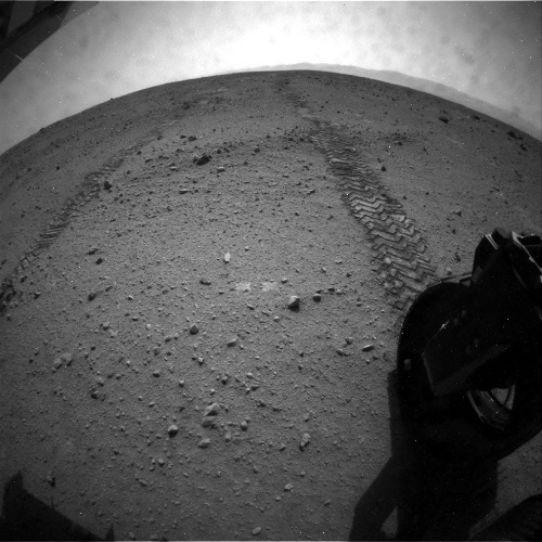
The most important for me was the latest HiRISE image from above as it shows the rover’s recent movements beautifully. You can see the tracks the wheels have made.
NASA/JPL/UA
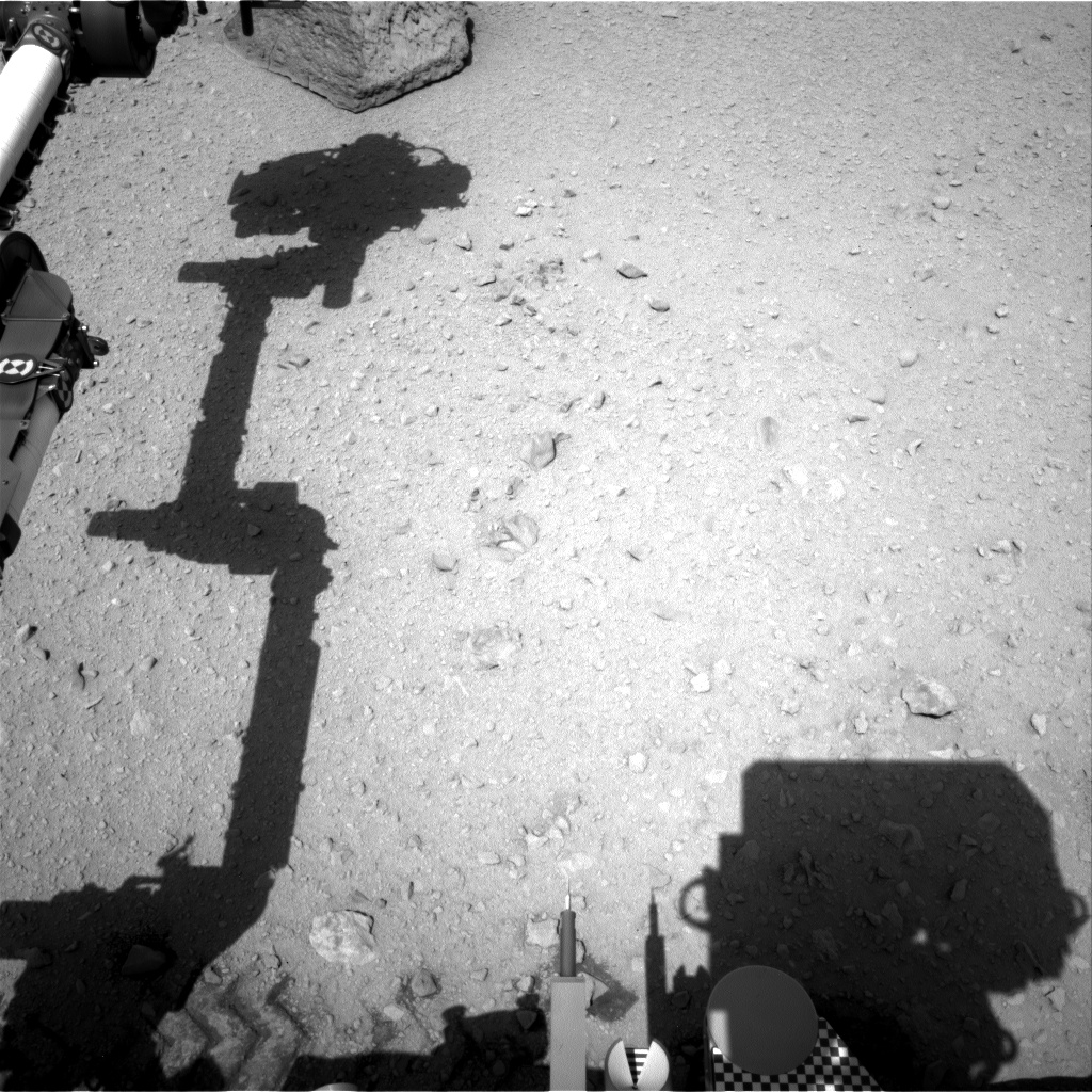
Below is the view looking back towards Bradbury landing from Curiosity’s position on sol 29. 
Sol 29 view looking back (NASA/JPL-Caltech/mosaic by me)
The rover has now transitioned to a phase called the ‘Commissioning Activity Phase 2’ (CAP 2) where they will now begin testing out the 2.1m long arm and the instruments at the end of it. Previous phases included CAP 1A (which included activities between landing and the software updating phase on sol 8), CAP 1B (which included remote sensing instruments like the Mastcams-100 and 34, the meteorology packages the DANS instrument as well as the laser-shooting ChemCam). This was all followed up by a period of remote sensing and drives beginning on sol 22 up to sol 29 which has put’s the odometer at 109m and 82m away from Bradbury landing.
NASA/JPL/UA
You can see the deployed arm below taken on sol 30 by the navigation camera. The position shown is called the ‘ready out’ position, sort of like a primer position.
Like a human arm, Curiosity's has a wrist joint (1), elbow joint (2) and shoulder joints (3), (4). Sol 30 view (NASA/JPL-Caltech)
Another position is called the drop-off teach points where they the arm assumes positions worked out while it was still on Earth which allow disposal of soil or rock core samples into the various internal laboratories.

Arm deployment and manipulation is tricky so it is important for the mission team to get a ‘feel’ on how to work with Curiosity. Once that is done, the science team will be given more power to effect decisions in the daily arm activities.

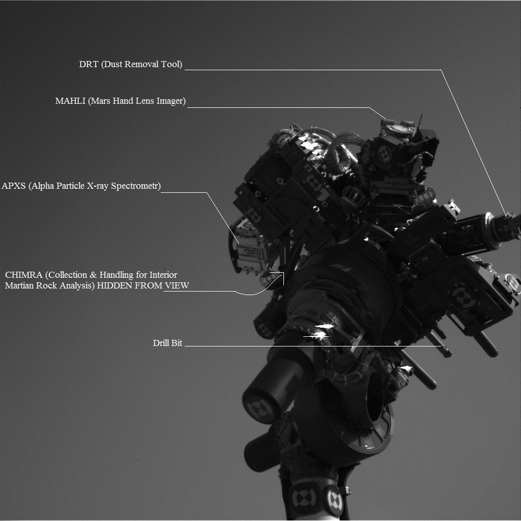
There were some really cool pictures taken of the instrument turret on sol 30. Below is the first from the navigation cameras while they were held high in the air, sort of like in will.i.am’s song ‘Reach for the Stars’. I have annotated the image to show the different instruments on the arm.
(NASA/JPL-Caltech/annotation by me)
Below is a color image of the turret from the 34mm mastcam which is the left eye. It shows the MAHLI instrument which is capable of imaging objects at infinity all the way to 21mm where it will produce images with a resolution of 14microns per pixel. The dusty dust cover is still on. The red circle in the middle of MAHLI’s cover is due to the lens refracting the red colour of the silicone glue used to hold the instrument’s nine lens elements and the sapphire window in place. The circular window is around the same diameter as a bottle cap.
View of MAHLI (NASA/JPL-Caltech/MSSS) 
MAHLI is scheduled to image the belly of the rover in the coming days. That is after they okay the retraction of the dust cover that’s still in the way. MAHLI has a calibration target, a set of colour and mineral standards set below the shoulder azimuth joint (the joint that turns the whole arm right and left). This target also contains the APXS’s (a spectrometer that uses an X-ray source to sense chemical elements in situ) calibration target, a piece of 
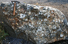
terrestrial volcanic rock called basalt.

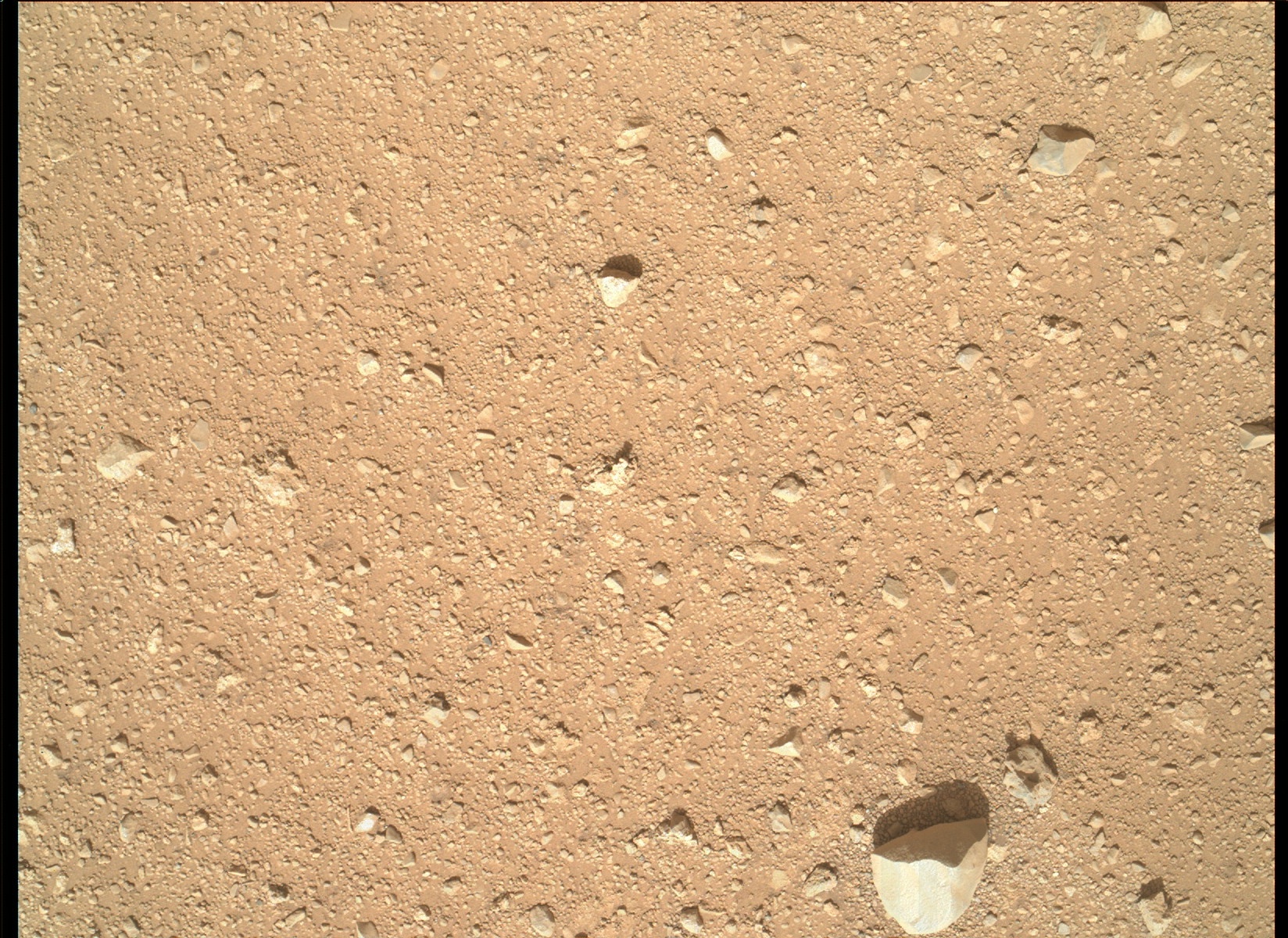
In the conference there was a question on the seriousness of the dents found on the wheels like the right middle one shown below. They were dismissed as ‘benign’ though they could have been made by anything; during driving or during landing. The wheels are made of aluminium. It would be interesting to see how they stand to the driving with time.
Dents highlighted by white circles (NASA/JPL-Caltech)
In other news:
Curiosity skipped arm testing on Sol 31 (Sept. 6) after controllers held back on new commanding due to a caution about a temperature reading on the arm. The issue was resolved later in the day, so the planned activities have shifted to Sol 32 (Sept. 7). These include a checkout of the tool turret at the end of the arm and a test using vibration of the sample processing device on the arm.
That sample processing tool is CHIMRA and it will be used to sort out particles by size in the core-powdered and soil samples for read outs by other instruments before depositing it in the sample inlets for the internal labs to analyse.


Thursday, September 6, 2012

Press briefing in 1 hour UPDATED

NASA's scheduled a press briefing on Curiosity's mission, set for 5pm GMT. I'll listen and comment on it later. You can watch it on NASA TV.

Apologies you can listen in HERE.

Tuesday, September 4, 2012

How's the weather at Gale?

Did you know they are giving daily weather bulletins on the weather at Curiosity's locality? The information comes from the REMS (Rover Environment Monitoring Station) instrument. Right now (i.e. sol 26) its sunny with temperatures at the highs of -1 degree Celsius and lows of -76 degrees Celsius.

Pressure is above the normal (636Pa according to wikipedia)  at 743hPa (that's hectopascal which is equivalent to 100Pa; terrestrial air pressure is 1013.25hPa). That's an average for the whole day mind you.

They're also supposed to produce daily average relative humidity but so far they haven't. This may have something to do with the damage the instrument reportedly suffered (see this post). Relative humidity is simply put the amount of air that is saturated with water vapour. On Earth it is usually measured using 2 thermometers. One is hung out dry the other is hung out while being soaked with moisture (usually with muslin). This is a basic hygrometer. The moisture evaporates in to the air, cooling the 'wet bulb'. The 'dry bulb' will obviously register a higher temperature compared to the wet bulb. This difference will decrease in areas with a lot of moisture in the atmosphere. A meteorologist will check the difference against a table that gives him/her the relative humidity in percentage. Deserts will have a very low percentage (which is why when you sweat in Dubai in the breeze, you'll feel cool). In a tropical forest, the percentage is higher and that 'humidity' gives you a devastating heat wave as there is no where for your sweat to go to cool you. Yikes!

Winds continue to blow from the east at 2m/s. The winds can hit higher speeds, atleast enough to start global dust storm events.

These past few sols consisted of remote sensing to spot clouds above the rover. Clouds at the equatorials are usually of the wispy types called 'cirrus' clouds consisting of water ice crystals.
Cirrus clouds on Earth (Commons)

You shouldn't expect anything more than that. I don't know why exactly (comments anyone?) but most of the action in terms of clouds is at the polar regions (presumably because most of the water vapour migrates there).

You can see what I mean by what the Phoenix space craft (which landed in 2008 at Vastitas Borealis near the north pole) captured in one of its periodic cloud spotting activities shown below. Simply awesome!


Clouds by Phoenix (Commons)
For periodic weather reports visit this website here.

Saturday, September 1, 2012

Sol 24 drive


Curiosity has completed its fourth drive sequence since landing on August 6. This drive took it 21m further east, bringing it to around not less than 380m nearer to its destination, Glenegl.

I have managed to produce a panorama using the navigation camera shots that the rover usually takes after every major drive (in order to update its position). Its not my best pan job but it serves the purpose of illustration. A good chap from unmannedspaceflight.com has started to produce kml files showing the position of the rover which we can view on Google Earth. So we can compare the two views.
360 degree view from sol 24. Note the tracks on the left side. (NASA/JPL/Panorama by me)
View of trek progress from Google Earth. (Google. Map by Tesheiner from UMSF)
The total mileage so far should be not less than 43m (that’s only an estimate as I don’t remember how many metres they drove in the first drives, only how far they went from Bradbury Landing).

In other news, NASA has released a brand new HiRISE image from MRO (the telescopic camera in orbit that can see desk-sized objects on the surface) taken of the rover and its scattered landing hardware and it’s better than previous images because the angle of roll (the angle between the camera’s line of sight and the line perpendicular to the surface which would be ‘nadir’) was only 9 degrees which would improve the imaging quality as your subject isn’t placed so far away. It also means less of the atmosphere in the way which would otherwise produce a worse shot with the increased amount of dust in the way.
View from HiRISE (NASA/JPL/UA)
You can see plenty of debris around the rover in exquisite detail (you can even see, in the ballooned insets, the rover’s wheels, shadow of its mast and the RTG [radioisotope thermal generator] attached to the back of the rover).

It’s now approaching evening of sol 25 at the landing site. Stay tuned.